🛒 Shop
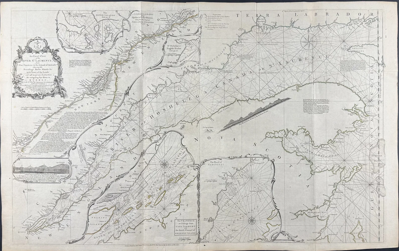
Jefferys, pub. 1775 - An Exact Chart of the River St. Laurence from Fort Frontenac to the Island of
Price
$ 600
Secure Purchase Protection
Verified sellers — All sellers are manually vetted.
SSL encryption — Your data is fully protected.
Returns guaranteed — Full refund for misrepresented items.
Balance protected — Funds held securely until delivery.
This rare, historic map is Thomas Jefferys's The American Atlas; or, a Geographical Description of the Whole Continent of America; Wherein are Delineated at Large its Several Regions, Countries, State
Shipping information will be provided by the seller after purchase.
Payment is processed securely through our platform.